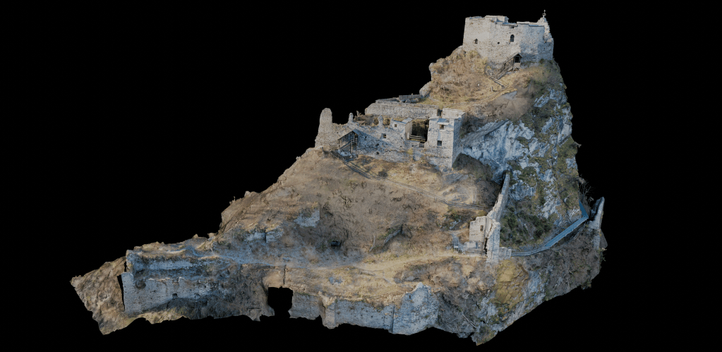
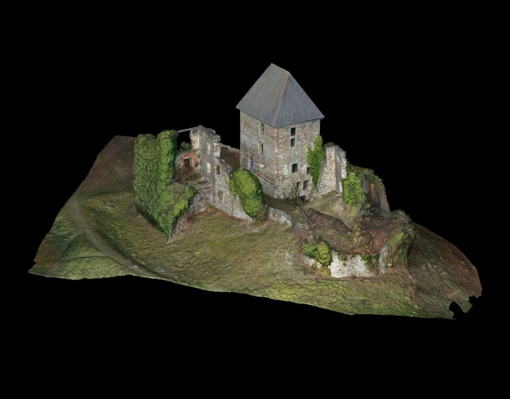
Eppenstein (2024)
The castle was first mentioned in 1160 and consists of a romanic roundcastle on the top, a gothic palas below and later fortifications all around. The site was already ruinous by the 16th century and inhabitated until the early 17th century.
The site has been scanned in November 2024 with the allowance of Burgverein Eppenstein.
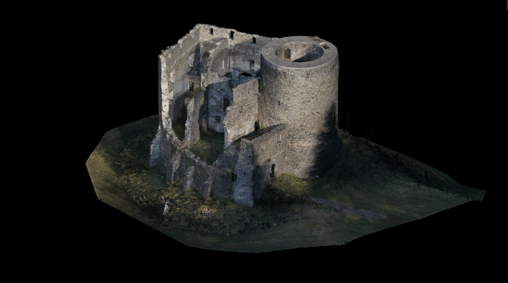
Ziegersberg (2023)
The castle dates back to the 13th century with the romanic main tower, which is the most significant feature of the site. The tower is surrounded with living quaters from the 15th and 16th centuryThe tower. The castle was abandoned in the 19th century after it lost its military relevance.
The site has been scanned in 2023 after the invitation of the Historischer Verein Wechselland
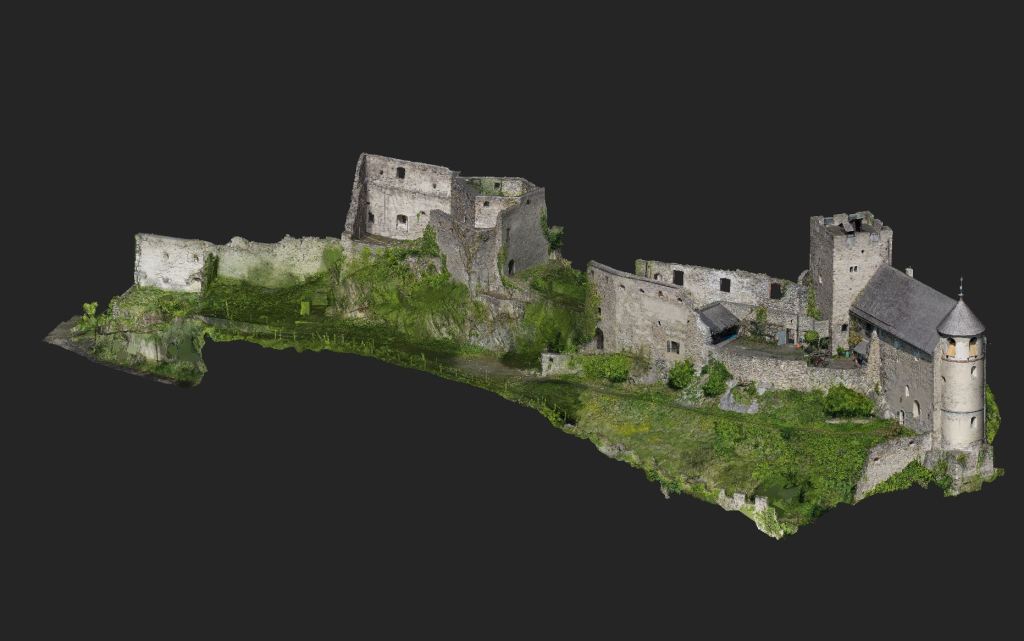
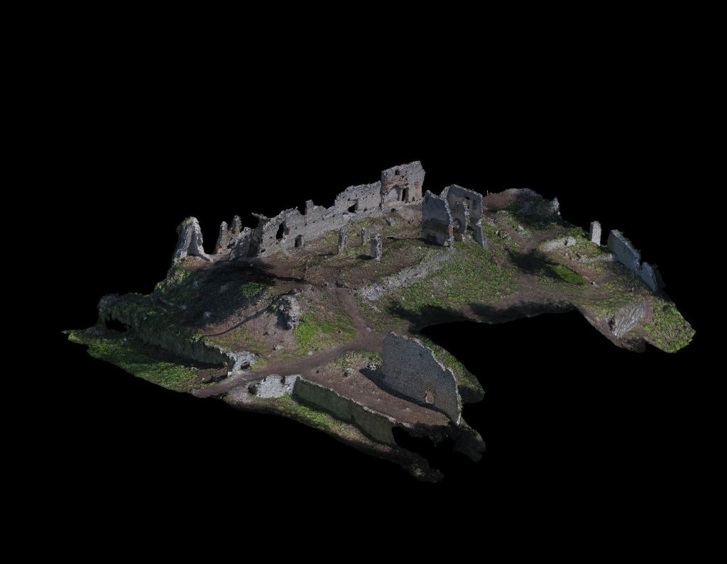
Gösting (2023)
The castle dates back to the 11th century with its inner wall and the main tower. The castle extended and maintained until the 18th cenutry, when a lighting hit the powder chamber and made it inhabitable.
With allowance of the city of graz the site has been scanned in 2023 as part of the terrestrial laserscanning lecture at TU Graz.
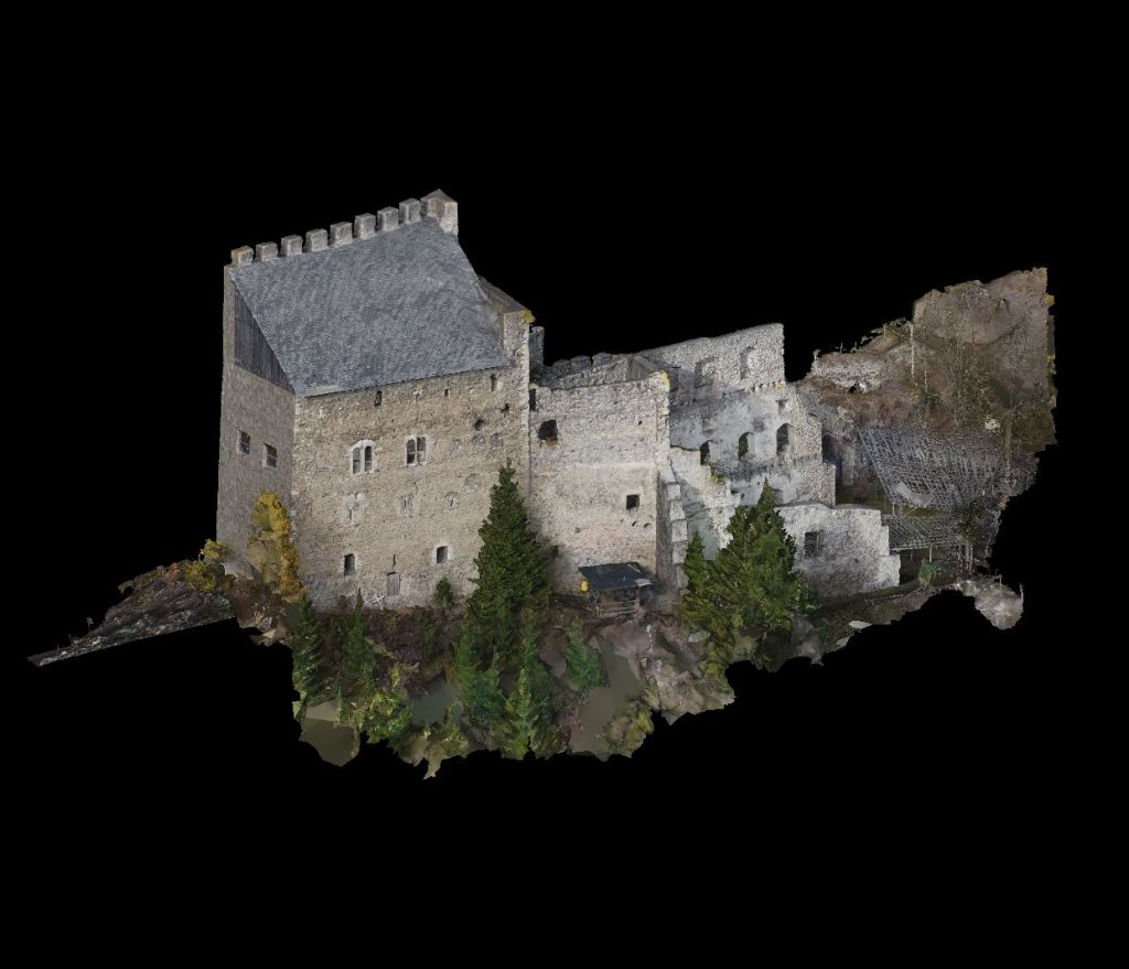
Frauenburg (2022)
The most prominent feature of the castle is the tower house from the 12th century. Additional living quaters have been added in the 14th and 15th century. It was inhabitated up to the beginning of the 19th century until a fire in 1861 has excelerated the decay.
However major parts have survived until today. Also because of the effort of the Steirischen Burgenverein who has saved the the towerhouse in the 1960s.
The site has been scanned with the allowance of the Familie Schwarzenberg in 2022 and imaged with an extensive drone survey. The data will be used for a digital reconstruction of the inital appearance of the castle in the 15th century.
Ligist (2021)
The main tower was errected in the early 13th century. The sourrounding walls were added in the 14th century. The living areas were modernized in the 16th century and a cannon platform was errected in the 17th cenutry. It was destroyed by napleonoic troops who burned the castle down.
Today it is in the possession of the Malteser Order and maintainaced. The survey has been carried out with DJI Drones and a geodetic total station for the measurement of ground control points.
The site has been photogrammetrically captured in 2021 with the allowance of Malteser Ritterorden.
Neu-Wildon (2020)
Neu Wildon is the oldest and main part of the Wildon castle complex. The building was errected in the 12th century, extended in the 14th and 15th century and transformed into a living place in the 16th century.
In 2020 the vegatition has been removed from the ruine as part of major renovation work. This was a unique oportunity for scanning and photografing the site for detailed 3D docmentation by Graz University of Technology.
Alt-Wildon (2021)
The main towers is believed to be errected in the 1400 and was sourrounded by a wall and several secondary buidlings. Due to mining activities in in the castle area, the southern part of the ruine has completly disappeared and therefore the original appearance can hardly be reconstructed. Also the foreworks have been destroyed and only a chapel ruine remains from the 16th century.
The site has been scanned and imaged in a conservation project from Graz University of Technology.

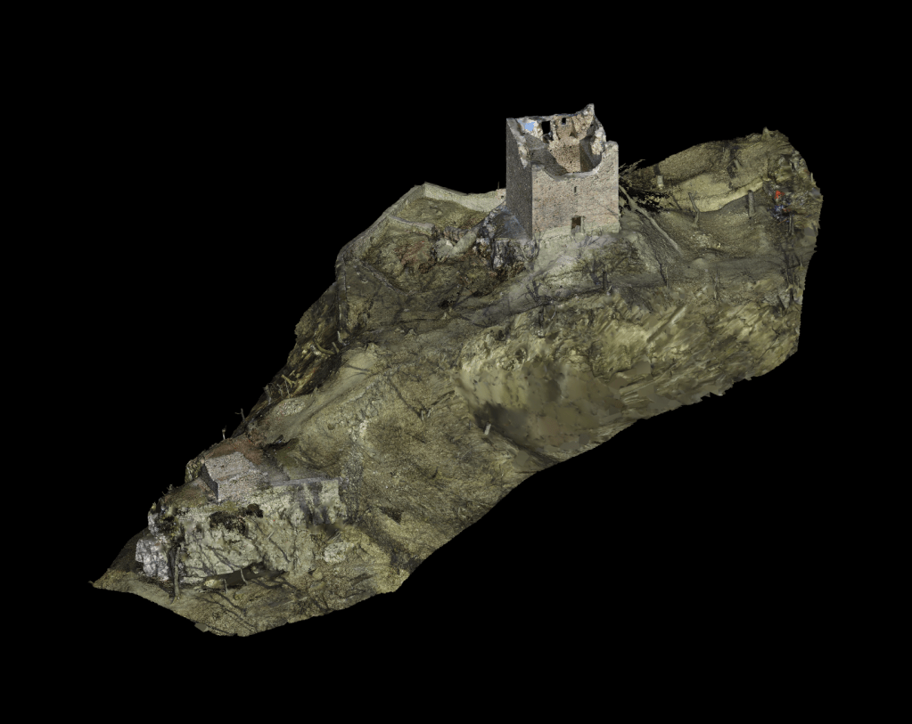
Hauenstein (2022)
The castle dates back to the 13th century and is a good example of a gothic tower castle. The main tower is still in proper condition till today, although later amendments in the 15th century already collapsed. The structure was abandoned in the 16th century, therefore the site has preserved its medieval appearance.
The 3D model was derived from airborne photogrammetry with local scale measurements. Terrestrial measurements for precise inner geometry with total station or laser scanner is still pending.
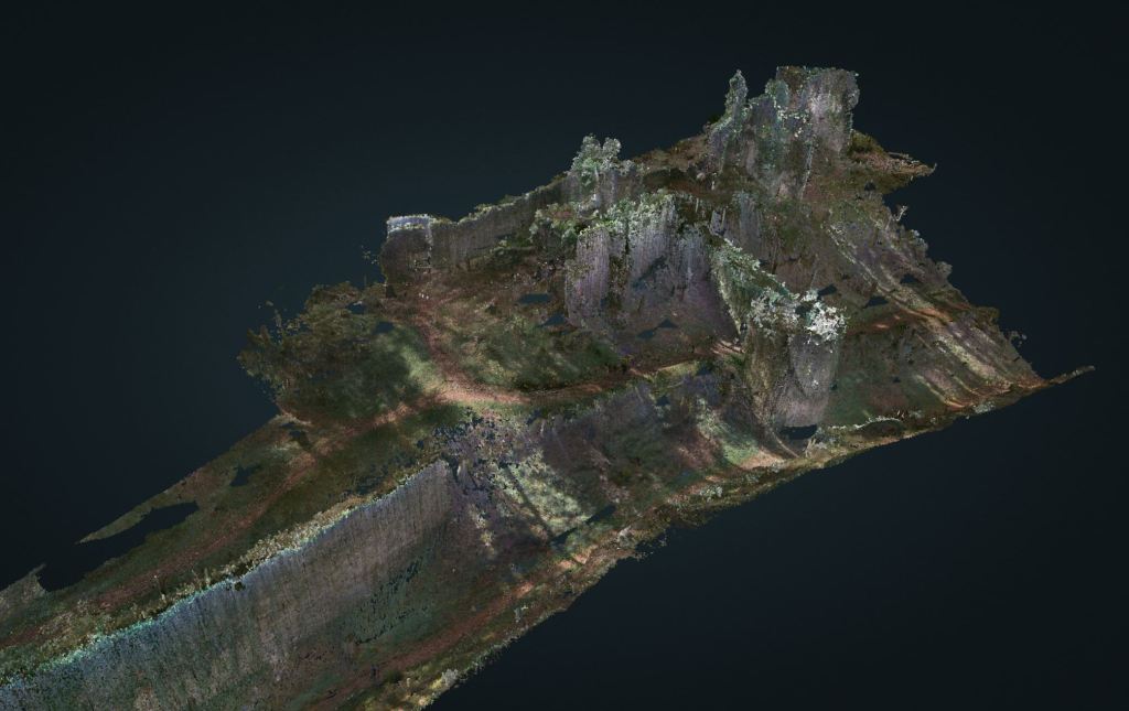
Neu-Leonreuth (2022)
The castle dates back to the 13th century and is a good example of a gothic castle in styria. The high castle fits the topology of a „Hausburg“ and was extended with a massive surroundings in the 14th century. A highlight of castle today is the well preserved defensive ditch and the inner cistern.
The survey has been carried out with a mobile laser scanner. The viewer shows the low resolution point cloud that covers the geometric features of the site.
